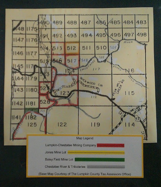
Here’s a great map showing the Lumpkin Chestatee Mining Company property in Dahlonega, GA:
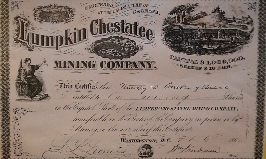
Timothy Grocken purchased 1000 shares @ $20 per share in the Lumpkin Chestatee Mining Company.
Here’s a great map showing the Lumpkin Chestatee Mining Company property in Dahlonega, GA:
Timothy Grocken purchased 1000 shares @ $20 per share in the Lumpkin Chestatee Mining Company.
Here’s another great map of the gold mines around Dahlonega
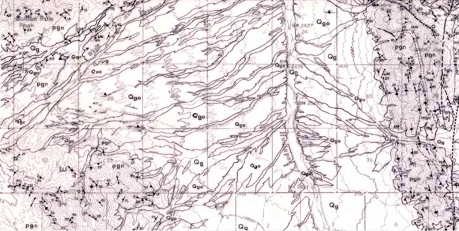
I’ve been promising some resources for gold prospecting outside of Georgia and here is a great map of the Mohave desert placers just north of Dolan Springs. Just take Pearce Ferry Road from Dolan Springs to drive up there. There are GPAA claims in the area and other gold club claims or you can file your own claim too!
Here’s a photo of the placers just south of Golden Rule Peak. The diamonds show the location of known gold placers
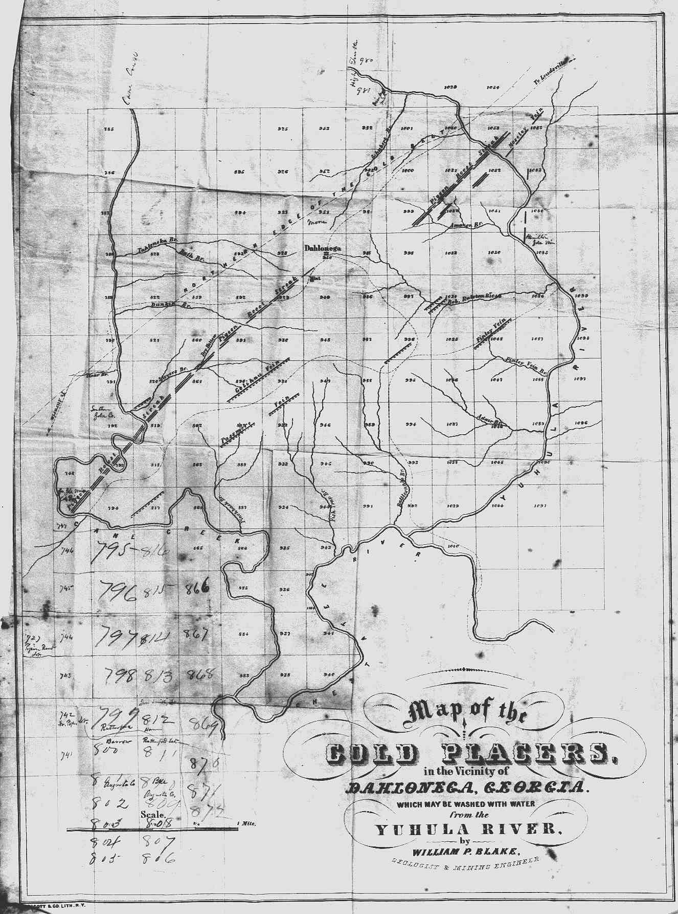
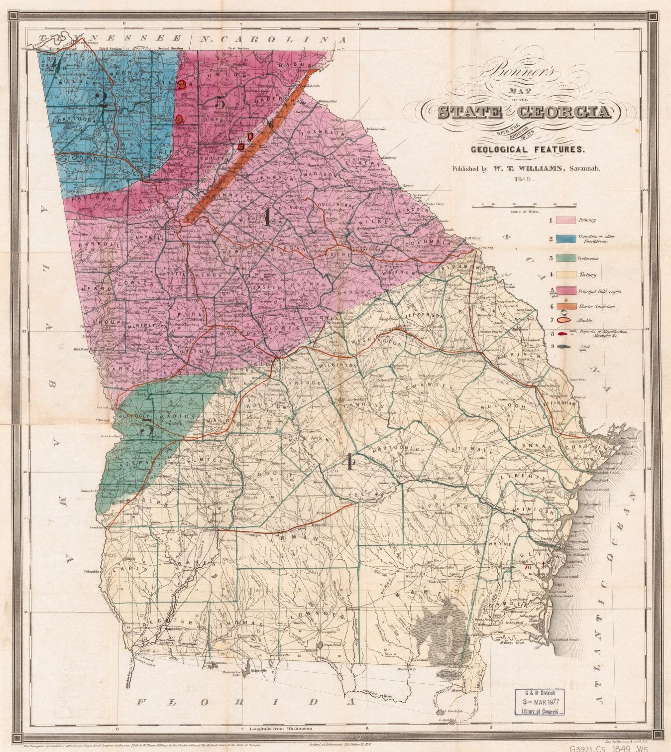
No discussion about gold mining in Dahlonega would be complete without the following 1849 map from William P. Blake (the state geologist in that year).
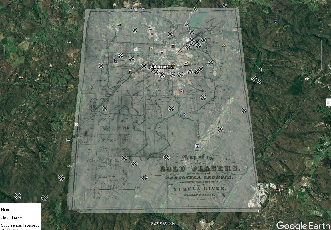
I love google maps and this map really help show where the gold placers around Dahlonega are located. Here’s the map imported in Google Earth, if you missed the post about how to do that, you can visit it here:
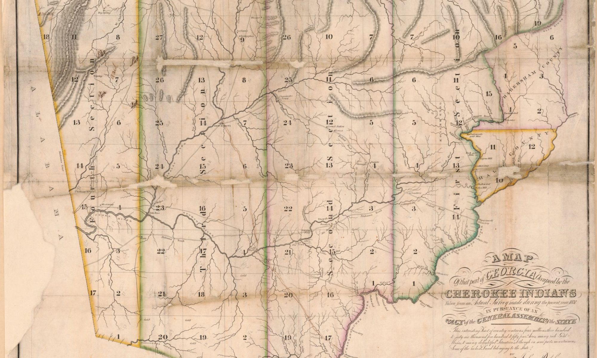
This map of the Cherokee nation from 1830 is pretty cool:
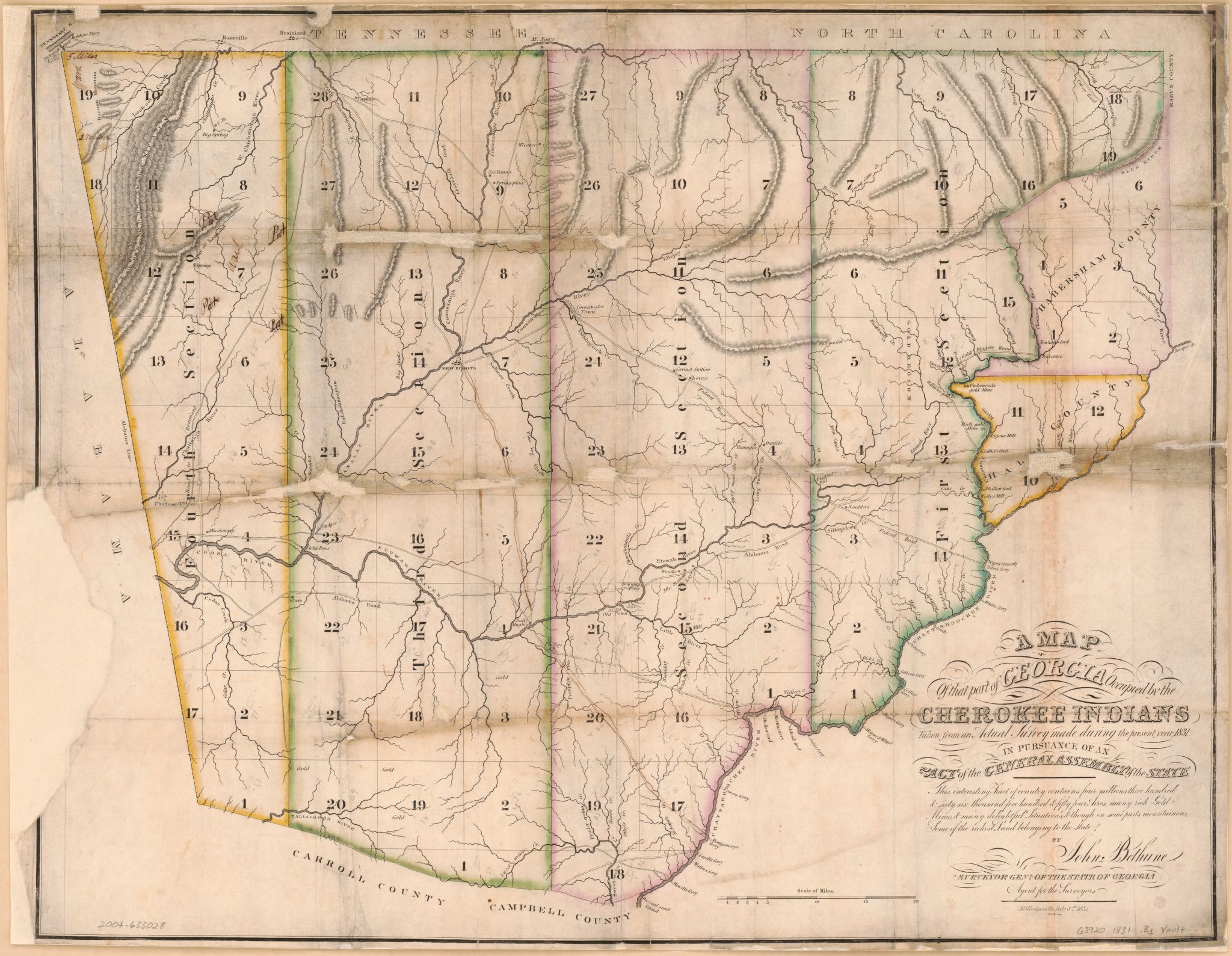
and here’s a another map from 1831 showing the Cherokee nation:
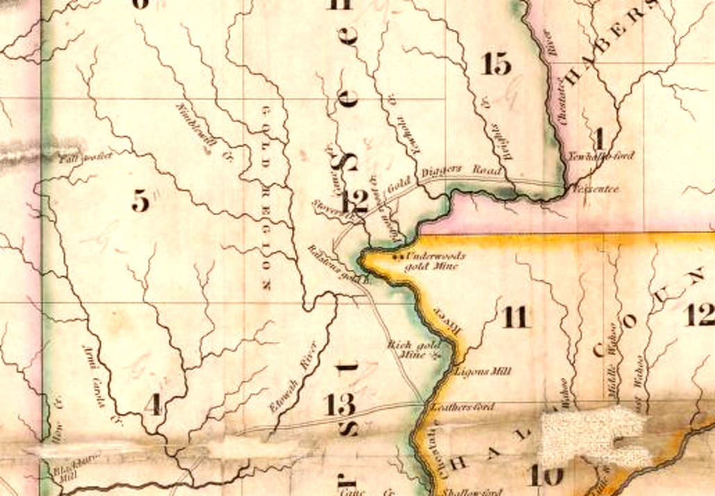
I love on this map the area around Etowah River is called Gold Region and Pigeon mine, Underwoods mine and “rich gold mine” are clearly marked on the map!
and finally, here’s a later map from 1849 showing the principal gold region in Georgia:
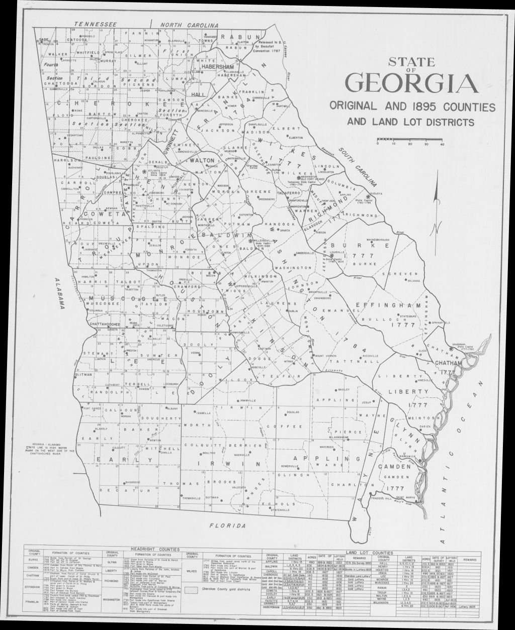
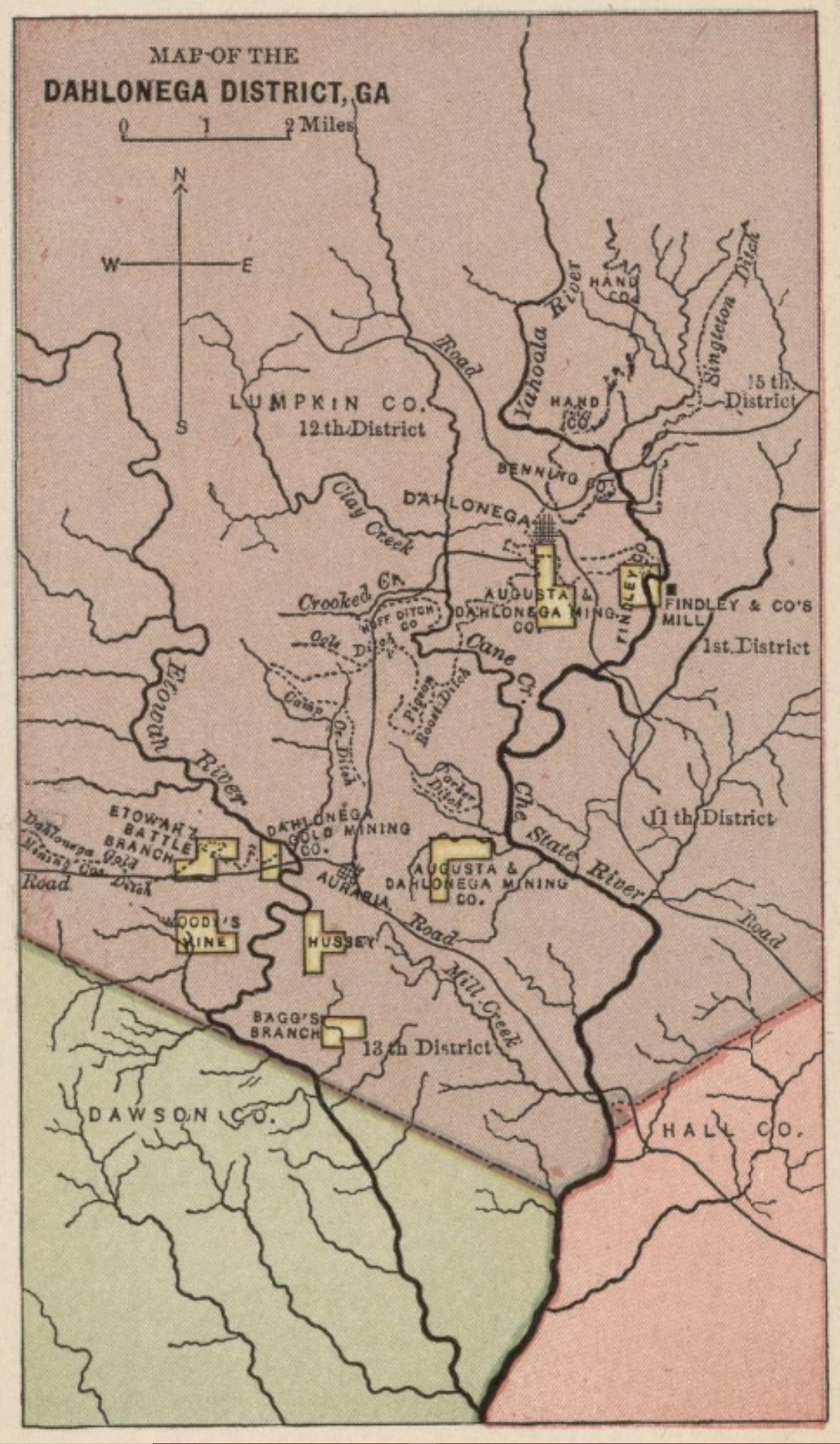
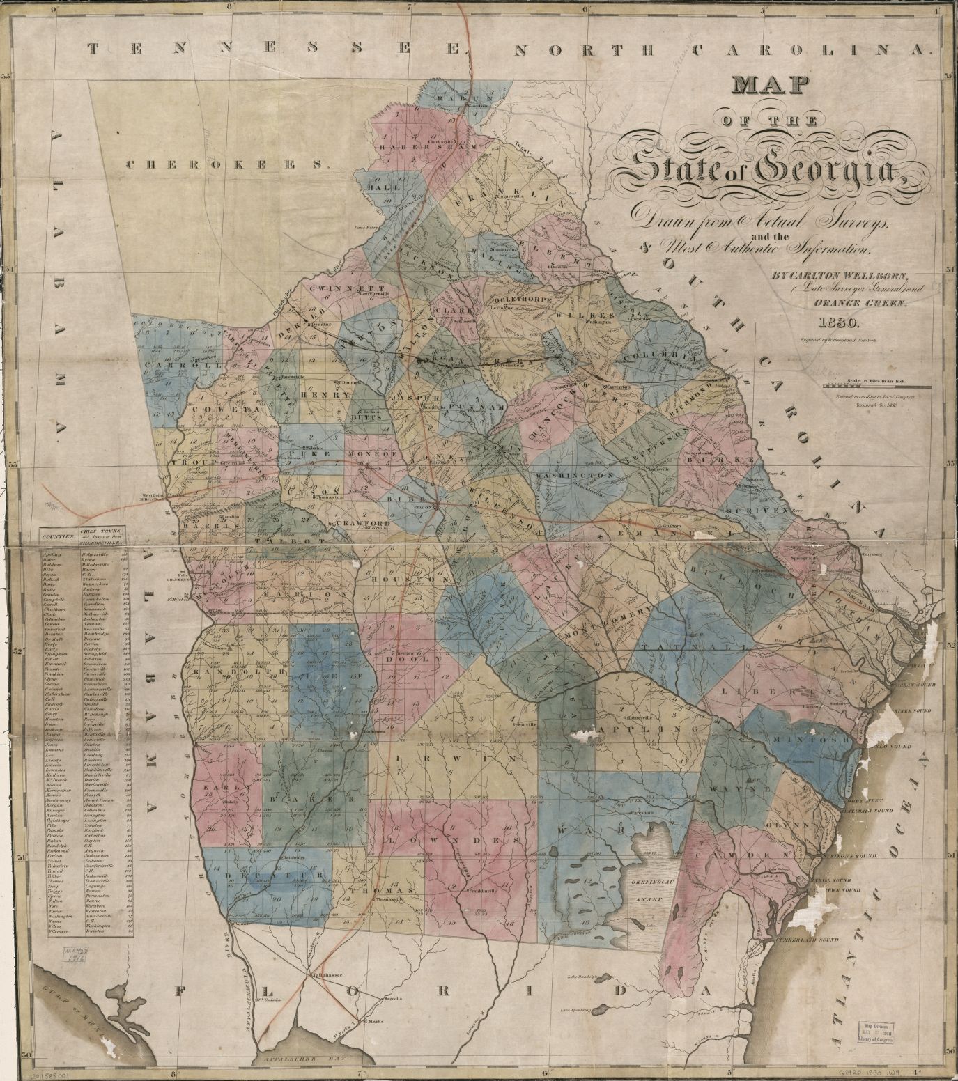
You can never have too many old maps, so here is the 1895 land lot map: